Version Française disponible en bas de page
Overview
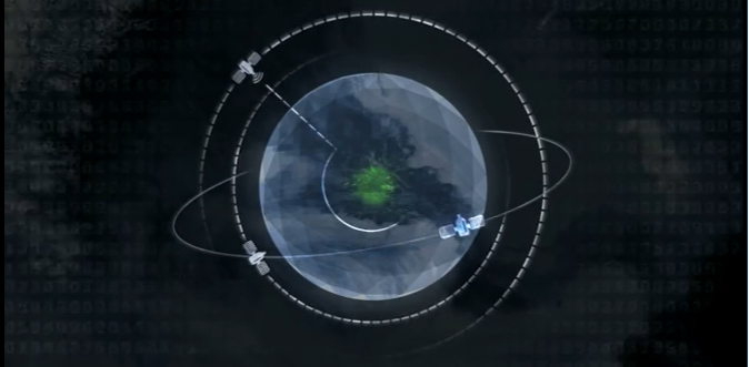
Over the last few years, the increase in the number of commercial satellite constellations at higher spatial and temporal resolution along with innovation in image-analysis techniques and the increase access to open data platforms has made satellite derived analysis a key asset to support operational planning and decision making during sudden-onset disasters, as well as humanitarian crisis situations.
To ensure the timely delivery of satellite analysis and derived products (maps reports, web services, etc..), It is best to coordinate satellite imagery analysis requests through the IM network to reduce duplicate requests. Please see the best practice section below for more tips on requesting satellite imagery analysis support.
Images from above: A review of aerial assessment in support of humanitarian response operations, (IFRC Needs Assessments Working Group, 2020). The study provides comprehensive view on how aerial assessments, its tools, and approaches have been used so far in humanitarian operations and outlines clear recommendations.
Resources
UN-SPIDER Knowledge Portal (space-based information for Disaster Management and Emergency Response)
Guidance to Satellite Imagery Interpretation: Displaced Population Camps
UNOSAT
The UNOSAT Rapid Mapping Service provides satellite image analysis during humanitarian emergencies, both natural disasters and conflict-situations. With a 24/7 year round availability to process requests, the UNOSAT team ensure timely delivery of satellite imagery derived analysis, maps, situational awareness reports, statistics and GIS-ready data (for example flood extents, damage assessments, etc,)
UNOSAT benefits from a variety of sources for satellite imagery acquisition: free and open source, commercial vendors, International Charter Space and Major Disasters (natural and technological disasters only), in-kind donations.
Note that in case of major natural disaster events, UNOSAT can activate the Space Charter and Major Disasters on behalf of the UN agencies and IFRC .
How to Activate UNOSAT Rapid Mapping Service:
Satellite imagery requests to UNOSAT related to both complex emergencies and natural disasters are to be sent to emergencymapping@unosat.org, CC: fis-ocha@un.org (OCHA Field Information Services) and Rahel Getachew getachewr@un.org.
The details to be provided in the request include the following:
Geographic Bounds (coordinates, KML, SHP, etc.)
Temporal Bounds
Operation(s) it will support
How will the data be used?
What do you need to see? What Questions are you trying to answer?
List partners, that will use the data. What are their licenses for derived works? (e.g. OSM has a creative commons license this can be discussed)
Who will benefit? (e.g. HCT, affected the population, UN agencies, NGOs, government etc.)
E-mail with details should be sent first followed by a phone call to the 24/7 hotline +41 75 411 4998 to confirm submission to UNOSAT on-call officer. Requests can also be submitted to 24/7 hotline directly if no internet connection available for e-mail.
The service is free of charge for UN sister agencies and humanitarian entities operating in line with UN policies.For more information about the process please see: UNOSAT Rapid Mapping Service
Best Practices
Coordinate requests through the IM network to reduce duplicate requests and improve common understanding of operational needs (IMWG members)
Once the request has been handled and delivered, please fill in the feedback form which is already attached within the request form. Feedback submission is a mandatory procedur
During sudden-onset natural disasters to know Who is doing What and Where by different satellite mapping organizations in terms of satellite analysis you can access the GDACS Satellite Mapping Coordination System (SMCS): http://smcs.unosat.org/
Most satellite imagery is licensed and sharing the raw imagery can be restricted. In case of need to access raw satellite images during an activation you can contact UNOSAT and ask advise regarding suitable mechanisms to grant access.
Collaborating with other partners that may be able to help such as Open Street Map (OSM), MapAction, REACH etc. so they can use the data and images.
Consider the expertise and time involved with satellite imagery analysis, let the experts dot it! Maps and GIS-ready data in different formats (e.g. flood extents, building damage points, etc,) can be downloaded from UNOSAT website.
In case the International Space Charter and Major Disasters is activated you can also check availability of satellite derived maps on the Charter Website Map .
Resources
See UNOSAT Geospatial Catalogue for examples of satellite imagery derived products you can request to support humanitarian operations.
Images satellites
Description
Les images satellites sont souvent une source utile pour générer un aperçu rapide d’une situation précise. Il convient toutefois de noter que les conditions météorologiques peuvent entraver la capture d’images satellites utilisables, avec des délais pouvant aller jusqu’à plusieurs jours, ce qui peut remettre en cause la pertinence de l’utilisation des images. Il est préférable de coordonner la demande d’images satellites au travers du réseau de gestion d’information, ce qui permettra d’éviter le cas de requêtes multiples et d’assurer que la licence attribuée permette l’utilisation des images par tous les partenaires. Reportez vous à la section Meilleures Pratiques ci-dessous pour plus d’informations concernant la demande d’images satellites.
Images from above: A review of aerial assessment in support of humanitarian response operations, (IFRC Needs Assessments Working Group, 2020) “Un examen de l’évaluation aérienne en appui aux opérations de réponse humanitaire” vise à fournir une étude complète sur la manière dont les évaluations aériennes, ses outils et ses approches ont été utilisés jusqu’à présent dans les opérations humanitaires et présente des recommandations claires.
UNOSAT
The Rapid Mapping Service (UNOSAT) provides analysis of satellite images during humanitarian emergencies, whether natural disasters or conflict situations. With 24/7 availability all year round to process requests, the UNOSAT team ensures the timely delivery of analyzes derived from satellite images, maps, situational awareness reports, statistics and data ready for GIS (e.g. extent of flooding, damage assessments, etc.)
UNOSAT benefits from various sources for the acquisition of satellite images: free and open source, commercial suppliers, The International Charter "Space and Major Disasters" (only for natural or man-made disasters), donations in kind.
Note that in the event of a major natural disaster, UNOSAT can activate the International Charter “Space and Major Disasters” on behalf of United Nations agencies and the International Federation of Red Cross and Red Crescent Societies (IFRC).
How to activate UNOSAT rapid mapping service
Request for satellite images for natural disaster or complex emergency situations should be sent to emergencymapping@unosat.org , CC: fis-ocha@un.org (OCHA Field Information Services) and Rahel Getachew getachewr @ un .org .
Here are the specifications to be provided with your request:
Geographic delimitation (geographic coordinates, KML, SHP, etc.)
Time limits
In support of which operation (s)
How will the data be used?
What should you be able to see? What are the main questions you are trying to answer?
Provide the list of partners who will use the data. What are the licenses in case of reuse of the data.
Quels seront les bénéficiaires ? (Ex. HCT, population affectées, Agences UN, ONGs, gouvernement etc. )
Steps of the request:
Sending an email containing the specifications of your request;
Contact the number +41 75 411 4998 accessible 24/7 to confirm the request with a member of UNOSAT staff. If it is not possible to connect to the internet, requests can be submitted directly by telephone.
The service is free for sister United Nations agencies and humanitarian entities operating in accordance with United Nations policies. If you would like more information about the process, please refer to: UNOSAT Rapid Mapping Service
Best practices
Coordinate your requests through the information management group (IM network) to avoid duplication of requests and improve common understanding (members of the information management group).
Once the request has been fulfilled, please complete the comments / feedback form which is attached to the request form. Submitting comments is part of the regulatory process.
During natural disasters to find out WHO is doing WHAT , WHERE in terms of analyzing satellite images, you can consult: GDACS Satellite Mapping Coordination System (SMCS) - http://smcs.unosat.org/
Most satellite images are licensed and sharing of raw data may be subject to conditions. If you need to access raw satellite imagery during an activation, you can contact UNOSAT and seek advice on the appropriate mechanisms to grant access.
When making your request, remember to include partners such as Open Street Map (OSM), MapAction, REACH etc. so that they can also use data and satellite images.
Take into account the skills and time required to analyze a satellite image. GIS-ready maps and data, available in different formats (eg extent of flooding, damage points to buildings, etc.) can be downloaded from the UNOSAT website .
In the event of activation of the International Charter "Space and Major Disasters" , you can also consult the availability of maps derived from satellite images on the Interactive Map of the Charter.
Ressources
Le Catalogue Géospatial UNOSAT vous donnera un aperçu de tous les produits basés sur des images satellites, qu’une Opération Humanitaire peut demander.
Vidéo Rapid Mapping UNOSAT en anglais (Aperçu) (Vidéo entière)