COD Tutorial: How to evaluate COD-AB topology
Resource:
Downloadable version for the steps below: Quick Check Steps (This process description uses ArcGIS. The standard license is sufficient)
Preliminary notes
- COD-AB topology errors are one of the spatial criteria evaluated described here in the Dashboard and Evaluations for Core CODs tutorial. Administrative boundary layers can only be assessed as 'fully useful' if all spatial criteria including the topology evaluation are satisfied. As the set of all administrative boundary layers for a country is given the evaluation of the worst administrative boundary layer (from administrative levels 1 to 4 inclusive), any topology errors will disqualify the 'fully useful' rating for the country.
- COD-ABs should be evaluated for two topological rules:
- "Must Not Have Gaps" (Legitimate islands will cause "Must Not Have Gaps" false positives. If there are many islands they can add time, complexity, and risk of mistakes to the topology fixing process described here Insert link. These can be avoided by preparing and evaluating a union of the COD-AB and a surrounding 'world' polygon shapefile, which is then removed after any topological errors are fixed. This optional process should be done at the beginning of the COD-AB topology evaluation and is described below.)
- "Must Not Overlap"
- It is generally only necessary to evaluate the topology of the lowest available administrative boundary level, as higher levels are normally dissolved from lower levels which should contain all higher level attributes, and dissolving does not introduce new topological errors. However, the evaluation may be made to any level at any time.
Process
Optional 'world polygon' union process
- Use the ArcToolbox > Analysis Tools > Overlay > Union tool to combine the shapefile or feature class with a 'world' polygon. For the most universal applications, a 'world' polygon is a shapefile or feature class with one polygon that extends from 90°N to 90°S and 180°E to 180°W, although any polygon completely surrounding the COD boundary polygons will be sufficient. A sample 'world' polygon shapefile is available here. The resulting union will become the 'input shapefile or feature class' described below.
Topology evaluation process
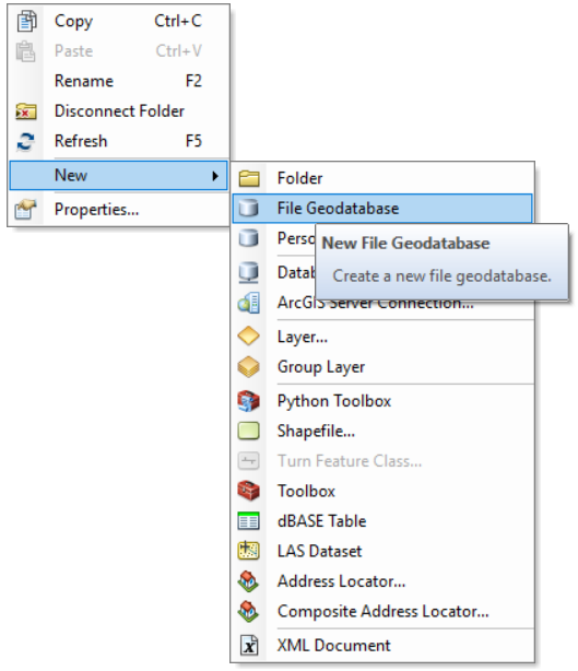
- Using ArcCatalog create a new file database by right-clicking in a suitable folder
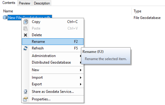
- Rename the file geodatabase appropriately
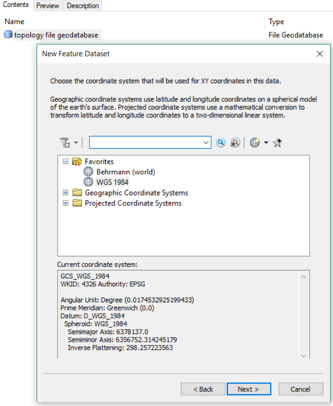
- Right-click the new file geodatbase and create a new Feature Dataset. Name the Feature Dataset appropriately.

- Name the Feature Dataset appropriately.
- Rigth-click the file geodatabase and create a new feature dataset.
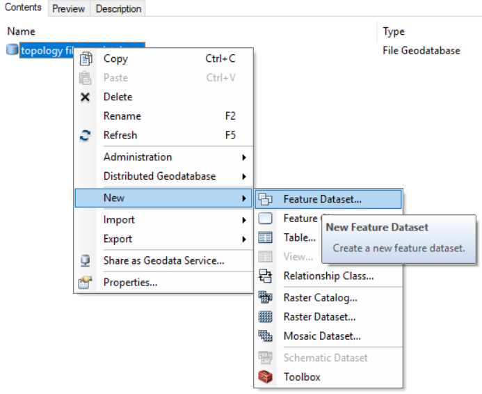
Name the new feature dataset appropriately
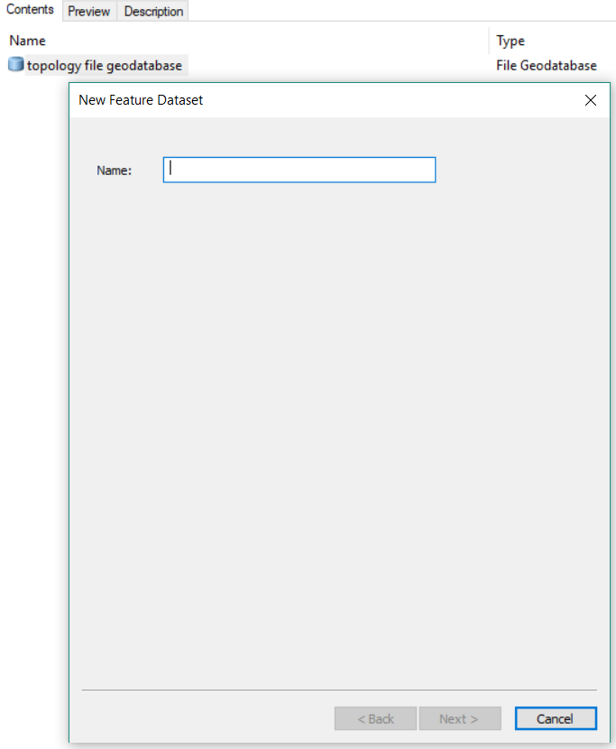
(The feature dataset name may not contain spaces.)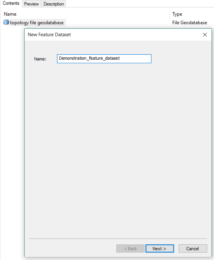
Accept the default coordinate system
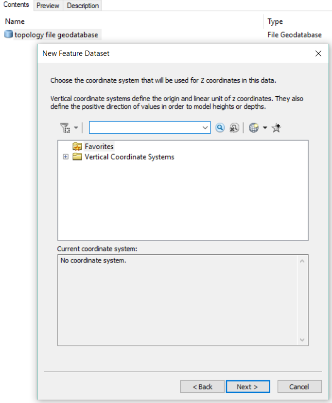
Also accept the default coordinate system for Z values
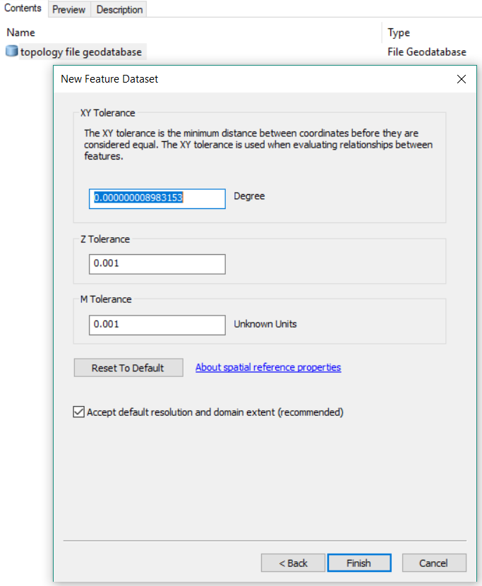
Accept the default XY tolerance
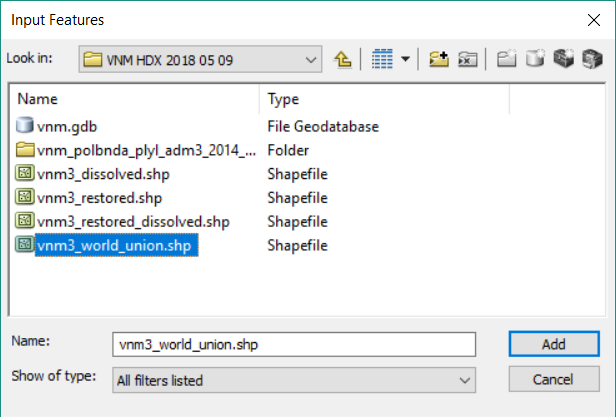
- Right-click the geodatabase and import the administrative boundary shapefile or feature class into a new feature class. Name the new Feature Class appropriately.
.PNG?version=2&modificationDate=1525867614074&cacheVersion=1&api=v2)
- You should now have a new File Geodatabase, containing a Feature Dataset, which contains your Feature Class (the shapefile or original Feature Class to be evaluated).
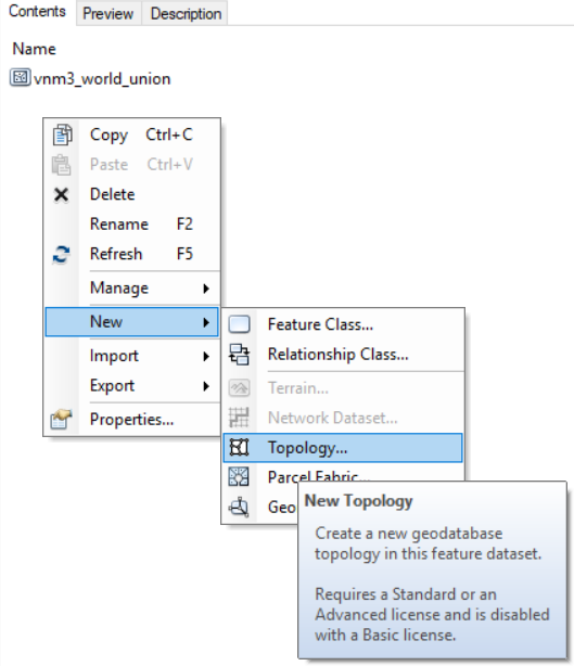
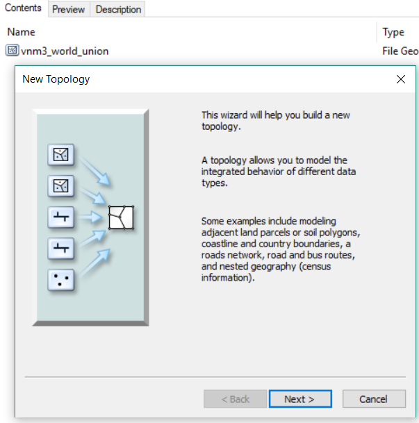
- Right-click the Feature Dataset (not the Feature Class) and select New > Topology