Overview
A simple definition of mapping is "the process of making maps". Humanitarian mapping refers to the production of spatial information to provide evidence-based situational analysis and enable appropriate decision making. Humanitarian mapping is a key part of the information management process. It starts at the analysis stage and ends with a final product at the communication stage.
Mapping is one of the most vital skillsets of OCHA’s information management officers. There are different kinds of maps depending on their style, size, format, software used, the information that needs to be conveyed and their intended use. For some basic standards and guidelines, check the guidance section.
Process
There are different kinds of mapping tools. Some are leading edge in the map making process and others are emerging technologies. For more information on mapping tools, see the following sub-pages.
Outputs/Resources
Community and Open Source Network:
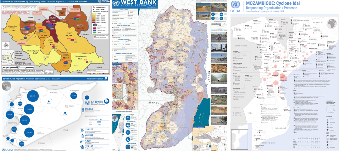
Examples of reference maps created with Data Driven Pages template:
One Minute Map Hacks playlist by Cartographer, John Nelson - https://www.youtube.com/playlist?list=PLPjPOZQjCWEnsT8RPYluAx3Eqe4ZVxDvS
SpatialStats github – great data visualization for spatial analysis presentations: https://spatialstats.github.io/presentations/
Humanitarian GIS Hub: https://explore-humanitarian.hub.arcgis.com/
Guidance
Mapping/Graphic Styles Resources
OCHA Graphics Stylebook - Visual Identity, the latest version
Templates: Assets include Logos, Fonts, Humanitarian Icons, Libraries, and OCHA core graphics. Templates include Infographic/Map (AI), Reports (InDesign), PowerBI, ArcGIS, PowerPoint, Word, Business cards.
Data Driven Pages templates: developed by FIS team and used in the 2021 Haiti Earthquake and Philippines Typhoon Rai emergencies. See examples under Outputs/Resources
Maps and Infographics: Link to where sample humanitarian maps and infographics can be found for inspiration.
Tutorials
How to consume COD services: A step by step guide to consuming COD web services (COD services) for developers and non-developers (e.g. tableau users)
Map Automation with ArcGIS Data Driven Pages
Data Driven Pages Toolbox: Python script developed as toolbox that can be used to export Data Driven page maps to PDF from the ArcToolbox.
How to create Data Driven Pages: useful links from ESRI