One of the desirable features for COD-AB datasets is a line shapefile with an 'admleveladmLevel' attribute field designating the administrative level of each line segment i.e., '0' representing international borders (but '99' representing coastlines), '1' representing lines between distinct administrative level 1 units, etc. These files are necessary for the best cartographic symbology. The alternative is to symbolize all polygon boundaries so that higher level boundaries have multiple symbols. (Even if these are carefully disguised by symbol size and order, shorelines cannot be symbolized properly.) ITOS makes these line shapefiles when they process your countries but if a country is not yet ITOS processed the coded line file can also be made with these instructions.
...
| Administrative levels in boundary polygon shapefile | Required new fields in boundary polyline shapefile |
|---|---|
| Administrative level 0 | 'AdmLeveladmLevel' (integer) |
| Administrative levels 0 and 1 | 'LEFT_A0', 'RIGHT_A0' (normally text) 'AdmLeveladmLevell' (integer) |
| Administrative levels 0, 1, and 2 | 'LEFT_A1', 'LEFT_A0', 'RIGHT_A0', 'RIGHT_A1' (normally text) 'AdmLeveladmLevel' (integer) |
| Administrative levels 0, 1, 2, and 3 | 'LEFT_A2', 'LEFT_A1', 'LEFT_A0', 'RIGHT_A0', 'RIGHT_A1', 'RIGHT_A2' (normally text) 'AdmLeveladmLevel' (integer) |
Note that in the unusual case of numeric P-codes, the new fields should also be numeric. The LEFT and RIGHT fields can be removed after the process is complete, so their names do not have to be those shown.
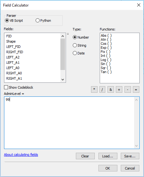
- Verify that the AdmLevel the admLevel values have all been set to zero. Calculate them to zero if they are not.
...
ADMINISTRATIVE LEVEL 0
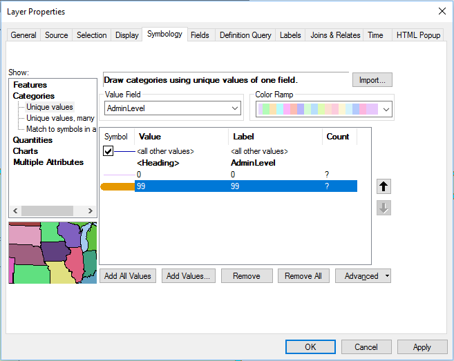
- Verify that AdminLevel that admLevel was set to 0 for all features when the field was created. If this is indeed the case then it is only necessary to adjust AdminLevel adjust admLevel to 99 for shoreline features according to the SHORELINE TREATMENT section below. Higher administrative level boundaries will be re-coded later.
...
| TIP: Displaying the input polygon shapefile can suggest the location of individual line shapefile segments, which makes them easier to select. |
|---|
|
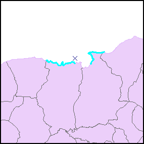
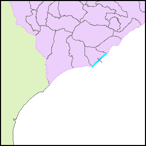
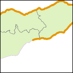
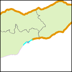
- calculate AdminLevel calculate admLevel = 99.
| TIP: For complex cases, select and calculate the line segments in sections. Establish line symbology that clearly distinguishes the calculated segments. |
|---|
|
...
| Explanation: Definition query "LEFT_A0 = RIGHT_A0 and LEFT_A1 <> RIGHT_A1" will select the line features that are not administrative level 0 borders (either shorelines or international borders) but are separating administrative level 1 units. |
|---|
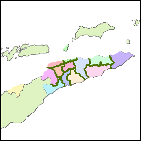
In this map the administrative level 1 polygons are shaded to show that the lines separate administrative level 1 units. |
- calculate AdminLevel calculate admLevel = 1.
- set a definition query for LEFT_A1 = RIGHT_A1 and LEFT_A2 <> RIGHT_A2;
- calculate AdminLevel calculate admLevel = 2.
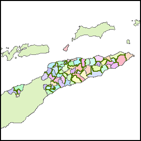
In this map the administrative level 1 polygons are colored to show that the lines are only inside the polygons |
|---|
...
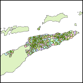
- Set a definition query for 'LEFT_A'2 = 'RIGHT_A2'; calculate AdminLevel calculate admLevel = 3.
| Explanation |
|---|
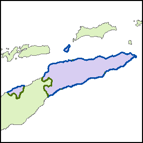
International borders and shorelines
Administrative level 1 lines:
Administrative level 2 lines
Administrative level 3 lines |
...