One of the desirable features for COD-AB datasets (and COD-EM) datasets is a line shapefile with an 'admLevel' attribute field designating the administrative level of each line segment i.e., '0' representing international borders (but '99' representing coastlines), ; '1' representing lines between distinct administrative level 1 units, etc.; and integers between 10 and 90 reserved for special-status boundaries. These files are necessary for the best cartographic symbology. The alternative is to symbolize and sequence all polygon boundaries so that higher level boundaries have multiple symbolsdominant symbols, revealing lower level boundaries in between. (Even if these are carefully disguised by symbol size and order, shorelines cannot be symbolized properly.) ITOS makes these line shapefiles when they process your countries COD-AB and COD-EM datasets but if a country is not yet ITOS processed the coded line file can also be made with these the following instructions.
The process may be unnecessary for island or landlocked countries containing only administrative level 0 polygons.
INSERT EXAMPLE
toc.
Polygon symbolization example
Colombia ("Colombia - Subnational Administrative Boundaries" COD-AB available on HDX here)
The Colombia COD-AB features administrative levels 0, 1, and 2. These levels will be symbolized with successively wider and darker lines, with the administrative level 0 (international / shoreline) boundary widest and boldest.
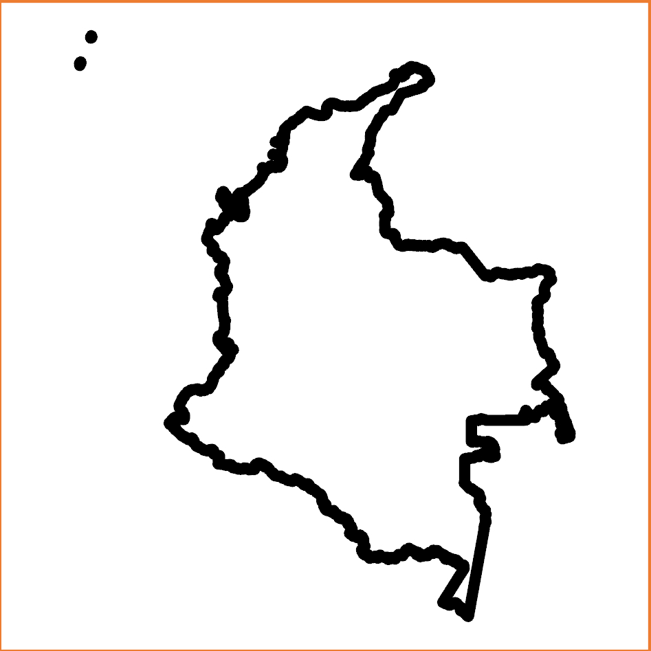
Colombia administrative level 0 (international / shoreline) polygon symbolization
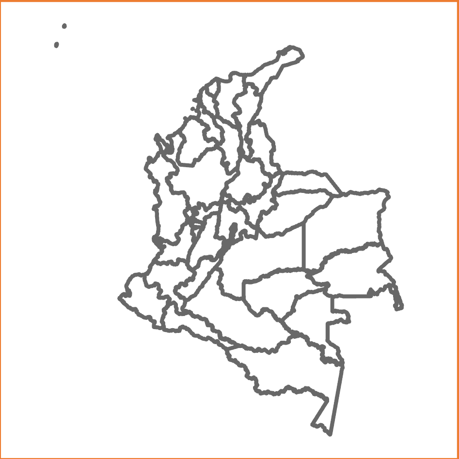
Colombia administrative level 1 (department / capital district) polygon symbolization
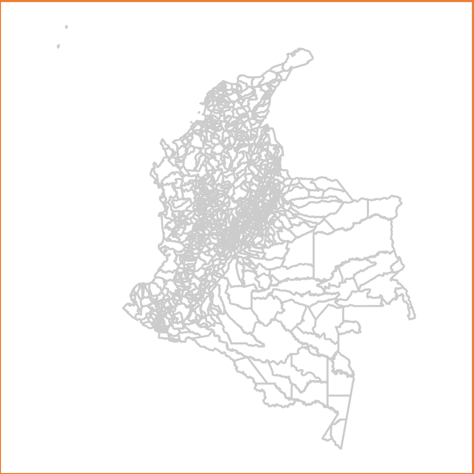
Colombia administrative level 2 (municipality) polygon symbolization
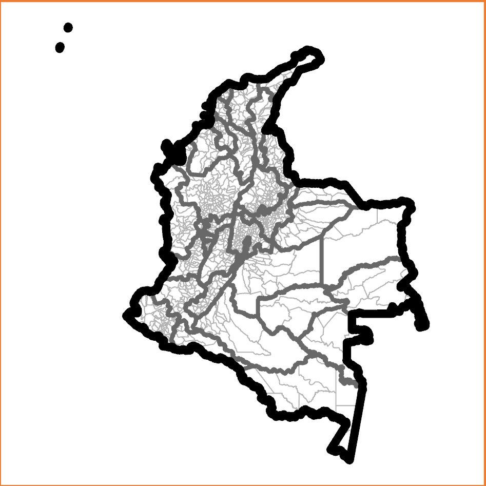
Colombia, crude administrative level 0, 1, and 2 polygon symbolization
This crude method of cartography using polygon symbolization cannot depict shorelines or other special-status boundaries distinctly.
Preferred line symbolization example
Table of Contents
One of the desirable features for COD-AB (and COD-EM) datasets is a line shapefile with an 'admLevel' attribute field designating the administrative level of each line segment i.e., '0' representing international borders (but '99' representing coastlines); '1' representing lines between distinct administrative level 1 units, etc.; and integers between 10 and 90 reserved for special-status boundaries. These files are necessary for the best cartographic symbology. The alternative is to symbolize and sequence all polygon boundaries so that higher level boundaries have dominant symbols, revealing lower level boundaries in between. (Even if these are carefully disguised by symbol size and order, shorelines cannot be symbolized properly.) ITOS makes these line shapefiles when they process COD-AB and COD-EM datasets but if a country is not yet ITOS processed the coded line file can also be made with the following instructions.
The process may be unnecessary for island or landlocked countries containing only administrative level 0 polygons.
STEP 1: Create the polyline shapefile.
...